Showing posts with label Travel. Show all posts

Sunday, January 8, 2023

Los Algodones

i recently visited and was impressed at the easy access to a border town.  A large parking lot is adjacent to the border crossing and is well suited to crossing the border on foot.  Parking is owned by an Indian Tribe which has no competition.  $6/day for supervised (and presumably 'safe")  IS reasonable, though.

 https://en.wikipedia.org/wiki/Los_Algodones

As the article probably says, the town is popular with USA citizens seeking low cost medical care.  The plastic surgery, dental, eye care, and prescription drugs are good examples of business thriving there.

I was shopping for prescription drugs.  During COVID, I had trouble seeing my doctor in order to renew prescriptions.  So, I made several trips, over a year or so, to buy in Mexico.  One of my four blood pressure drugs was hard to find on the other side of the Texas border.  A pharmacy in Los Algodones was able to supply that drug.  Total time in doing the Los Algodones crossing was less than two hours.  Los Algondes has the reputation of being one of the safest of the border towns.  My observation supports that.  When I went, a year or so ago, to Matamoros (across from Brownsville), I was astonished at the business stagnation.  Rumors are that the town is mostly controlled by Mexican criminals.  To a lesser extent, that seems true about many other Texas border towns.  Nuevo Laredo is still a very nice place to walk across but the tourist business is very poor.  I intend to visit Reynosa in the next year or so.

If a reader knows the meaning of "Algodones", please comment.


Monday, June 20, 2022

John Wesley Hardin

 My great uncle, Frank Patterson of Junction, famously told and retold the tale of having an encounter with John Wesley Hardin during his youth.  Patterson lived from 1879-1969.  I met "uncle Frank" only once about 1953 when he was retired from Texas Rangers and Kimble County Sheriff in Junction.  John Wesley Hardin (I've been reading about him) lived from 1853 to 1895.  JWH was in prison from 1878 through 1894.

https://en.wikipedia.org/wiki/John_Wesley_Hardin

ONE of my pending "things to do" is visit Hardin's grave:

https://www.findagrave.com/memorial/1346/john-wesley-hardin

The story was that Frank was roaming brush land and practicing shooting a pistol.  Frank and friends unexpectedly met JWH and friends.  JWH opined that Frank had a poor quality pistol and gave him a better one.  That pistol and the story remained in Frank's collection long after Frank's death.

https://www.findagrave.com/memorial/29924103/cabot-frank-patterson

JWH went to prison before Frank was born.  And was killed only a year after his release from prison.  So, if the story is true, it would have had to occurred about 1894-1895 in the year before JWH was killed.  Frank would have been about 21-23.  Not the youth that I had understood.

Frank is believed to never have talked of his involvement of the Povenir Massacre of  Jan 28, 1918.  Frank left the Rangers a couple of weeks after the event.  But he was in Ranger Compay B under Captain Fox before he left the Rangers.

https://www.nbcnews.com/news/latino/porvenir-texas-details-massacre-mexican-americans-u-s-soldiers-rangers-n1059146

https://en.wikipedia.org/wiki/Porvenir_massacre_(1918)

Sunday, May 1, 2022

Dust Bowl. And Stuff

 I recently decided to tour through both panhandles: Texas and Oklahoma.  Dust Bowl country.  After the dust had settled down, the government bought much of the eroded land that was available.  Now, it is a patchwork of "National Grasslands".  Most of the lands remain in private hands and is mostly farmed.

I was surprised to see so much center pivot irrigation in the area.  And I was more surprised to see "dust devils" scattered about.  It turns out that the "dust devils" were clouds of dust rising from farm equipment doing plowing.  So, there is more wind erosion in progress than I would have thought.  The dust creation is likely very short duration, occurring only between crops.  Maybe two or three times a year.

I have (or had) a very nice sandy asparagus patch of about three acres.  With asparagus, you have a single opportunity to mechanically control weeds.  That is best done a week or so before the asparagus spears begin to appear.  The entire field can be disked at a shallow depth.  Hopefully staying above the crowns from which the spears arise.  I remember one year when we had inopportune winds following the annual weed clean up.  It hurt to see great clouds of dust rise from the field.  Good and irreplaceable soil lost.

So, I've been reflecting on soil conservation.  Over freshly plowed soil, wind will pick up and carry away the smallest particles first.  Leaving behind coarse sand and pebbles.  That changes the character and value of the soil.

One good remedy to such soil loss is "low till cultivation" or, better yet, "no till cultivation".  Both require increased herbicide inputs.  That raises the cost but avoiding or reducing tilling lowers cost.  So, the farmers are inclined to use more herbicides and use less tilling for the purpose of preserving soil.  There are, increasingly, market forces that discourage herbicide use.  Certainly, there is a a conflict.   Think about that the next time you demand "organic" from your fresh produce source.

I notice that there are a lot of what appear to be sand dunes in the panhandles.  Vegetated over and mostly stable.  Road cuts and other excavations reveal much sub surface sand.   I suspect that most of the center pivot land is smoothed up sand dunes.

From personal experience, I know that farming may not be profitable.  It has many economic ups and downs.  Most beyond the control of the farmer.  I recall that when I started growing peaches in about 1983, I knew I had to make about three crops of peaches out of each five years in order to stand a chance of being profitable over the long term.  In my first five years of peach growing, I made a single decent peach crop.  And, I branched out into blackberries, tomatoes and many other "truck" crops.  NONE were long term profitable.  Most farmers have similar stories.

One great fear of our government is agricultural failures resulting in food riots and maybe even starvation.  Because of that fear, agricultural subsides are wide spread.  Most modern farmers are dependent on "feeding at the trough" for economic stability.    Without subsidies, market forces would push many farmers out of business.  That happened during the Great Depression and dust bowl era.  The declines in production due to farmers being previously pushed out of business results in shortages later.  Hence, the government strives to keep farmers in business when short term market forces tells them that they should not be in business.  

Recall that the Russians, under Stalin, starved millions of Ukrainians as a political control method. 

Because of low profitability, aggravated by government subsidies, agricultural land is of generally low value compared the value for other uses.  "Development".  Ass backwards, IMHO.  Farming should be reliably profitable.  Farmers should be valued and honored members of society.   Farm land should be so valuable that "development" occurs only on "waste" land.  Dream on, Willie.


Tuesday, January 11, 2022

Brandon Mississippi

 https://www.brandonms.org/experience-brandon/history-of-brandon/


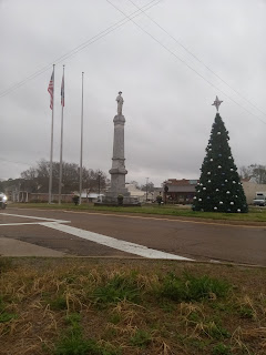
Brandon is a few miles east of Jackson Mississippi and I've recently passed through twice.  The upper photo is of the Caldwell County Confederate Monument prepared to move from the courthouse square.  On learning of the planned move and stimulated by a very liberal neighbor who supports the move, I became a member of the Sons of Confederate Veterans.  I have intentions to support SCV and their efforts of preservation of our Confederate heritage.  I gained membership through my great great grandfather, John Leggett Hargrove.  JLH lived in Brandon before moving to Shreveport where he and much of his family is buried.  The move perhaps precipitated by Yellow Fever threat in Brandon. 

https://www.findagrave.com/memorial/10714683/john-leggett-hargrove

The devil sherman burned downtown Brandon on his way to Vicksburg but JLH's home escaped.  I have a cousin that located and visited the house about 30 years ago and I have long intended to visit.  This trip, I was through on a Sunday and did not have the information needed to find the house.

The rather impressive monument in downtown was placed by the United Daughters of the Confederacy as was the now moved Caldwell County monument.  My grandmother, granddaughter-in-law to JLH, was a "Real Daughter" in the UDC.  That, by virtue of her father's Confederate service.  Whitfield Rogers Taylor.

https://www.findagrave.com/memorial/49067227/whitfield-rogers-taylor

Interestingly, Whitfield's brother served the Union and was an early recipient of the Congressional Metal of Honor:

https://www.findagrave.com/memorial/7881665/richard-taylor


Saturday, December 25, 2021

DeFuniak Springs

https://photos.app.goo.gl/FGkQpJiwXptW834w9
I first visited DeFuniak Springs about 2013 in a not Tesla. The SuperCharger was permitted at that time. But not known to be under construction.  I believe it was in DFS that I was introduced to the Southern delicacy of boiled peanuts.  I found no evidence of the pending SuperCharger.  Recently, while charging at DFS, I noticed the lake to the south of downtown on my Tesla map.  


And, became aware of the town's VERY interesting history.
Which led me to reading of the resurrection of the Chautauqua movement.


Thursday, November 11, 2021

Back country travel

 I just returned from a trip to southern Colorado and feel compelled to comment on the mostly vacant country I traveled both on this trip and others.  Much of the interest comes from communities that have severely declined (or disappeared) due to the Dust Bowl of the 1930s.  Photos from that recent trip:

https://photos.app.goo.gl/r1Uyo8vXUNKa7NJK6

This is the second time I have avoided the Raton Pass between Raton NM and Trinidad CO by traveling alternate Santa Fe Trail routes about 50 miles  to the east of Raton.  The diversion around Raton is a total of about 100 miles and goes through two nearly disappeared towns: Folsom NM and Branson CO.  On that 100 miles there is not a convenience type store or equivalent.  No place for a cup of coffee or a head break.  The photos include a bulletin board where you may read of the history of Branson.  The bulletin board and a solid concrete jail are features of a small municipal park maintained by the remaining people of Branson.

Note photos of "New Mexico Fence Corner Posts".  Columns of mesh wire filled with rock.  Reminds me of German rock fences you see in Texas Hill Country.  They served several purposes: keep teenagers occupied and tired, get rocks out of cultivated fields, build durable, useful, valuable, and long term structures.

Several years ago, I visited Claunch NM which is around 200 miles south of Colorado but is similar in history to Folsom and Branson.

 https://en.wikipedia.org/wiki/Claunch,_New_Mexico

https://photos.app.goo.gl/1MV6bG9rxYpedTqY6

Before the Dust Bowl, all three communities were thriving (perhaps semi-thriving) centers of farming with significant surrounding populations.  Now, the areas are desert or near desert with very sparse populations.

It is challenging to think of the areas before and during the Dust Bowl era.  Much of the most devastated land is now "National Grasslands"

https://en.wikipedia.org/wiki/National_grassland


Saturday, August 28, 2021

Hurricane Ida approaches Morgan City

How about a combination history and current events post?

As the hurricane approaches Louisiana, I'm reminded of the history of Brashear City where the Confederates had a notable victory.  325 Confederates took 1200 prisoners and significant stores.  Following Leander McNelly's tracks, I've visited the site of Fort Star in Morgan City.

https://en.wikipedia.org/wiki/Morgan_City,_Louisiana

Other accounts of the action give McNelly credit for the victory at Brashear City.  He is said to have convinced the Ft Star defenders that the Confederate force was much larger than it actually was; they surrendered without a major battle. Before that action, McNelly had participated in the Confederate invasion of New Mexico and, after the War of Northern Aggression, he went on to greater fame as a Texas Ranger with his "get tough" campaign against Mexican bandits and rustlers in the lower Rio Grande Valley.   

https://en.wikipedia.org/wiki/Leander_H._McNelly

McNelly is one of my heroes.  I've visited his grave, near Burton, several times.

I found an older post on McNelly:

https://wmckemie.blogspot.com/2020/01/web-journey.html

which includes a very interesting Austin genealogy connection with McNelly.

In the past few decades, Hwy 90 has been elevated for many miles through the swamps on both sides of Morgan City.   The highway now goes over Morgan City rather than through it.  Hwy 90 is to serve as a major evacuation route for New Orleans.

An aside.  The Corp of Engineers has major structures at the intersections of the Red, Mississippi and Atchafalaya Rivers to insure that New Orleans remains on the main Mississippi channel.  In flow from Red and Mississippi is controlled in out flows to Atchafalaya and Mississippi.  The Mississippi has been threatening to take the more western Atchafalaya route to the Gulf of Mexico for 100+ years.  Major flooding could destroy the structures and allow the Mississippi to have it's druthers which would put Morgan City on the main channel.  The structures currently give New Orleans about 2/3 of the flows of Red plus Mississippi and the Atchafalaya gets the other 1/3.

Another aside.  A couple of years ago, I made a most satisfactory trip to Grand Isle, then up Bayou LaFourche, through Thibodeau, to the origin at Donaldsonville on the Mississippi.  The Bayou, before human intervention, was one of the many outlets of the Mississippi to the Gulf o Mexico.   It goes through around 100 miles of delta country that is very near sea level.  I guess maximum elevation of about 20'.  Grand Isle is not a place you want to be during a hurricane; all roads withing about 100 miles are likely to be under water.

That trip was stimulated by recommendations of Grand Isle from volunteer "park hosts" at Hueco Tanks State Park east of El Paso.  Where I stopped for a few hours for a charge.  Grand Isle is one of their favorite places to serve as "park hosts".

9/2/2021

After the hurricane.  Houma is spread out up and down a bayou.  Bayou Cane, I think.  Bayou Cane is parallel and west of Bayou Lafourche.  Lots of good eateries there.  Damage/flooding over the entire area.   Thibodeau, Grand Isle, Houma, etc.  Maybe i should tour the area in a couple of months to see about the recovery.  Years after Katrina, many Nawlins neighborhoods remained devastated.

Thursday, August 19, 2021

Pike's Peak

Day one got a late start, around noon.  Charged at Bellmead, then at Cisco and Childress.  Overnighted at an attractively priced Childress motel.

Day two, charged in Amarillo, Clayton NM, Trinidad Co, and overnighted in a sleazy and overpriced Pueblo CO Motel 6.  $100.

Day three drove to Monument and charged at a new 250kw SuperCharger.  There is a SuperCharger in downtown Colorado Springs but I avoided it because it is in congested downtown and in a fee parking garage.  That charge in Monument allowed me to go back to Colorado Springs, up and down the mountain and then back to Trinidad.  In Trinidad, I noticed a Colorado legal marijuana store next door to the SuperCharger.  The building had been repurposed since previous Trinidad visits. I toured the very nice town of Raton NM and had a mid afternoon meal.  Then charged in Las Vegas NM.  Overnighted in a pricey Hilton two blocks from a McDonald's destination charger in Roswell NM.  Even at $160, the Hilton was a far better value than the Pueblo Motel 6.

Day four drove ~40 miles and checked out the new Artesia NM destination charge station at McDonalds.  Then,  through Pecos to Coynosa and bought some cantaloupe and got some dynamite green chili burritos for the road.  I finished them well before reaching the Ft Stockton SuperCharger.  Then, bypassing Ozona, charged again at Junction.  Then, home about 9-10 pm.  Road weariness is great for sound sleeping.

 https://photos.app.goo.gl/7PH4gJxRmDh1a2em9uelbo   

All images accessed through the above link can be made to show much more detail than the embedded images below.  Also, some comments associated with individual photos can be viewed via the above album link.  Viewers can add comments but I may not immediately notice.  I will likely more promptly notice comments made to this blog post.

On the way to Pike's Peak, I did not go over Raton Pass.  Instead, I took a route about 20 miles to the east.  The route of an old private toll road.  Photo #2 is of the toll gate and gate house.


Photo #10 shows iconic USGS benchmark placed at the Pike's Peak summit.


https://en.wikipedia.org/wiki/Survey_marker

Photos #13 and 14 show microwave dishes well hidden under view points.


#16 shows peak terminal of newly opened "Cog Wheel Railroad" from Manitou Springs.

https://en.wikipedia.org/wiki/Pikes_Peak_Cog_Railway

First operated in the 1890s.  I wish I had read the article BEFORE my trip! I would have considered going also to Manitou Springs.  Even though the area is VERY pricey.


Photos #19 & 20 are of Roswell destination charge station.


I first thought that the banged up Kia was an ICE parked maliciously to block a charge spot.  Closer examination revealed that it is an EV and was charging through a J1772xTesla adapter.  Something he paid $200-$300 for to allow charging at Tesla destination charge stations.  Aside from being generally banged up, it was missing doors on both sides.  My kind of car.   Apparently from Ruidosa.  Sadly, I did not have an opportunity to chat with the driver.  The charge station gave me my full 48 amps and would likely give 80 amps to those cars that can accept.

Test charging at McDonalds in Artesia, only about 40 miles south of Roswell:


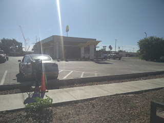
The visible pylon has a Tesla Wall Connector plus a Clipper Creek ~60 amp J1772.  To the right is a second pylon with two Clipper Creeks.  Both pylons visible below.   There are no hotels near that McDonalds; else, it could make an attractive overnight stop in order to get a full charge as I did in Roswell.


I'll speak a little here of future touristing possibilities.  And impossibilities.

I've briefly passed through a number of small towns I found enticing.  Worthy of future visits. 

1) Raton and Trinidad are paired, one on each side of Raton Pass.  Seemingly both old railroad towns  Both have many old and obviously loved buildings.  I was surprised to find that Raton has an old rail station repurposed as an AmTrack station.  Of course, Raton is saddled with the slightly embarrassing but mostly ignored name of "Rat".

2) Roswell has quite a few attractions.  The military academy seems to keep the town at least fairly prosperous.  History includes being site of a WWII German prisoner of war camp.  Also, Robert Goddard conducted early rocketry research in the area before WWII.  Both left tracks to be explored by tourists.   I imagine the military academy has an interesting history to be explored.

https://en.wikipedia.org/wiki/Robert_H._Goddard

There is a lot of extraterrestrial alien silliness that should be ignored.

3) Walsenburg CO is another smallish but very nice town that exhibits much citizen pride.

4) Route 66.  I noticed mention of 

https://www.electricroute66.com/

in my travels.  I have had enjoyable visits to many small towns that are intent on preserving their Route 66 history.  A not exhaustive list: Shamrock and Adrian in Texas.  In New Mexico: Tucumcari, Santa Rosa, Grants, Gallup.  Arizona: Holbrook, Winslow, Flagstaff, Seligman, Kingman.  Kingman has a couple of really great museums.  Oatman is on a section of Route 66 that goes over Sitgreaves Pass is now little used.


A bit on negativity.  Much of the Colorado IH25 corridor should be avoided.  From south of Pueblo to near Cheyenne WY.  It is much like the Texas IH35 corridor from south of San Antonio to near the Oklahoma border.  South of Pueblo all the way down to north of Santa Fe is pretty nice road.  Passing through the El Paso Texas area should be avoided though much of IH10 all the way to California is ok.   The route through the Phoenix area seems to be a poster child for working freeway design.


i

Saturday, July 17, 2021

EV Travel Adventures

Mainly posted for my own future reference.

I see the opening of the Canadian border is in the news.

Two years ago, I traveled as far north as Ft St John which is one charge beyond the last SuperCharger in Edmonton.  That is, I had to do some RV park charging to get between Edmonton and Ft St John.   Ft St John has a "destination charger" at a Microtel hotel.  The next stop north would have been Ft Nelson.  But I was not carrying a full complement of electric adapters and the only RV parks in Ft Nelson had only "30 amp" outlets.  So, I turned around.  Searching with rvparky.com, I see there remain 300-500 mile legs between RV parks with "50 amp" outlets on the route to Alaska.

https://www.google.com/maps/dir/Fort+St+John,+BC,+Canada/Fort+Nelson,+BC,+Canada/Watson+Lake,+YT,+Canada/Whitehorse,+YT,+Canada/Alcan+Border,+AK/@59.1560046,-139.9320241,5z/data=!3m1!4b1!4m33!4m32!1m5!1m1!1s0x539249b23cd026b5:0x56ba966ece75ce0a!2m2!1d-120.846409!2d56.252423!1m5!1m1!1s0x53eead910da086fd:0x5f2e4258bd5e0070!2m2!1d-122.697236!2d58.8050174!1m5!1m1!1s0x53fb59a95bb32ca3:0x8e010d3860a6ee53!2m2!1d-128.710913!2d60.062806!1m5!1m1!1s0x5154449880bc5381:0xe43db7ea64d0354b!2m2!1d-135.0568448!2d60.7211871!1m5!1m1!1s0x514b7eb749fce0c5:0xfd7a81c49e13a77e!2m2!1d-141.131215!2d62.6584334!3e0!4e1

 This source CLAIMS 50 amp service in Ft Nelson:

 http://www.campgroundsalaska.com/alaskahighway/yukoncampgroundsrvparks.php

I'm thinking that a CyberTruck might be a good vehicle for such travel.  I've become much enamored of the Quest TV series Yukon Gold and want to see the country around Dawson City (Yukon Territory) and Atlin (British Columbia).

https://www.questtv.com/shows/yukon-gold

I'm encouraged that Tesla is putting in more northern SuperChargers:

https://supercharge.info/map

In the nearer term, I'm thinking Pike's Peak and Key West:

https://abetterrouteplanner.com/?plan_uuid=954846ec-b105-49bd-a943-c258e4661f9d

https://abetterrouteplanner.com/?plan_uuid=ad35b87d-4a2e-4871-8b48-0ec08aae10af

Those would both be 4-6 day trips.

29 August 2021:

Tesla is making very good progress on the Canadian SuperCharger network.  By the time I get back up there, I am likely to be able to make a big loop through/around the Canadian Rockies rather than just going north and back south on the same route.  Though there is now one SuperCharger in Alaska, a SuperCharger connection to Alaska still seems far in the future.  They are on the verge of having two east/west SuperCharger chains all the way across Canada.


Friday, July 9, 2021

Trip to Pecos area

 https://photos.app.goo.gl/mZq5Z3ZCgeEGs7tq8

 Trip was primarily to check out the Pecos Cantaloupe situation.  See my recent Pecos Cantaloupe post.  I had recently learned that there is a single remaining truck farmer family in the area.  Oil has completely destroyed the pleasantness of the area and irrigated farming has almost entirely been replaced by oil businesses.  The photo album contains a few shots of a "man camp" which supplies housing to oil workers.


Also checked out the Rankin murals: 

http://www.tumlinsonart.com/eastward

https://www.texascooppower.com/texas-stories/life-arts/rankin-as-a-canvas


I encountered the Model 3 with bikes atop at the Ft Stockton SuperCharger on the way to  Coyanosa.  Since I have carried bikes on trailer hitch carriers, I chatted with the couple.  They reported that range reductions could be in the range of ~30%.  The roof mount (not the part that holds the bikes) was a Tesla option.  I would estimate that hitch carrier range reductions are around 10%.  I am reminded of the bike I discovered was lost when arriving at a SuperCharger on a west Texas leg; it had fallen off due to loosened clamp.  Recognizing the amount of time required and the likely condition of the bike, I elected not to go back ~100 miles looking for it.

7/15/2021

FLASH!  I'm learned that Jamie Mondajano is now making seasonal weekly deliveries to the Austin area:

https://www.therealpecosmelon.com/


Saturday, May 22, 2021

Pecos Cantaloupe

I think I'll semi-plan a Pecos trip for mid-July.  Bring home a few boxes of cantaloupe. Maybe before just to check out the Mondajano farm and get a reading on the cantaloupe season.  It is on a highway I don't believe I've traveled before.  SuperCharger stops at Junction and Ft Stockton.  Should be quick and easy trips.  I guess I could go on to Balmorea to see if there has been progress on the pool repair.

http://www.ntxe-news.com/cgi-bin/artman/exec/view.cgi?archive=74&num=111895

 https://www.lubbockonline.com/news/20190830/famed-pecos-cantaloupes-from-west-texas-now-rare-few-farms

 https://www.texascooppower.com/texas-stories/nature-outdoors/the-truth-about-pecos-cantaloupes

 https://www.houstonchronicle.com/news/houston-texas/houston/article/Pecos-cantaloupes-were-famous-Now-oil-rules-14273017.php

 https://goo.gl/maps/Ssuczi6eTH3xbriLA

Wednesday, December 30, 2020

Eat more kolatches

 I see this post was not nearly as amusing as intended.  I neglected to get the content published.  I'll have to try to bring it back from memory.


Trying to keep the floors free of debris seems a never ending task.  Stuff is tracked in every time I enter the house.  Counter intuitively, it seems more is tracked in than is tracked out.  The obvious solution is to just ignore.  A fine solution.  If I were willing to always wear shoes.  Which I am not.  The debris is painful to walk on barefoot.  Sweep every few weeks?  That's what I've been doing.  I deem too time consuming.

A few days ago, I made a kolache run to La Grange and Ellinger.  As usual, as I consumed the kolaches, I tossed packaging on the floor by the wood burning stove.  To be later tossed in the stove to contribute heat.  While walking around barefoot, I found the styrofoam trays that held the kolaches made for comfortable walking.  Perhaps a solution to the debris problem?  BUT, what happens when debris begins to build up on the styrofoam?  It gets pressed into the foam, is immobilized and makes walking more comfortable!  AND, when the foam trays are eventually picked up and tossed in the stove, much of the debris is embedded in the foam and goes with it into the fire.  The sweeping task is entirely eliminated!  IF I eat enough kolaches.


Saturday, September 12, 2020

Old friend recalls 1973 motorcycle trip to Mexico City

 I sometimes reminisce about that trip we took to Mexico, me on the SuperHawk, you on the 2-stroke Kawasaki 750. There were some interesting episodes. 


We left Austin in October, on the coldest day of the year until then. Heading south to connect with the old Panamerican Highway, it started to rain at Reynosa. The further south we went, the harder it rained, but it warmed up a little. We spent the night at Tamazunchale, in a cheap hotel across the street from the bus station. At dinner the truck drivers at the next table began to regale us with baroque tales of spectacular road accidents. The next morning it was so foggy you could see the backs of the buses parked across the street, but not the fronts. Undeterred, we started up the mountain.

After a few times coming around the corner to find big rocks in the road, or big rocks falling from the cliffs through the clouds and fog onto the road, we figured out why there was no traffic. The truck and bus drivers knew more than we did. Coming to the first short straight and level stretch in many miles, I decided to dry off my front brake. I squeezed the brake handle, but nothing happened. i squeezed a little harder and the rusty spot in the cable came loose, the front wheel stopped turning and I went down. I had on a rain suit, leather jacket, good gloves and helmet. As I slid along on my back, I noticed the bike headed for the guard rail, and thought, "If it goes under the guard rail, there's about a 1500-foot drop." Then I thought, "If I go under the guard rail..." Both the bike and I stopped before we went over the side.

Neither I nor the bike was notably damaged. We rode on until we came to the big Pemex station at Ixmiquilpan, the top of the long climb up the eastern slope of the Sierra Madre. The gas station has a good sized restaurant which has a beautiful view on a clear day. That day the visibility was about 20 yards. We were the only customers in the big restaurant. We were soaking wet. I was covered in mud from my sliding excursion. You literally poured water out the the sleeve of your rain suit onto the floor. By and by a pretty young girl, maybe 15 or 16 came out to wait on us. She looked at us, held in the giggles as long as she could, but broke down and fled back to the kitchen. After a while we could see her and a woman looking through the window in the kitchen door. The girl came back out, collapsed in giggles again, fled, recovered, and finally kept it together long enough to take our orders.

Coming in to the outskirts of Mexico City traffic began to thicken. I was out in front, stopped at a red light, when I heard a couple of loud thumps. Turning back to see what was going on, I saw you methodically kicking the driver's door of a taxi that had been crowding you. The driver sat still and looked straight ahead, studiously avoiding eye contact.

In Mexico City we checked into the Hotel Yale, near the big train station. The neighborhood was pretty dicey, but the Yale was clean, cheap, safe, and had a walled parking area for the bikes.

Riding in the rain for a few days rusted the key into the SuperHawk's ignition lock, where it couldn't be removed. I figured it was okay, since the bikes were in the walled and locked enclosure. The next morning we found that kids playing in the parking enclosure had turned on the headlight and run down the battery. We walked a couple of miles to the only motorcycle shop I knew of in Mexico City to buy a new battery. There was a big burly Mexican there, with an impressive beard, working on a cool looking old motorcycle. A sign above his head read, in English and Spanish, "This is a 1937 Zundapp. It is not for sale, and I will not answer any questions."

You stood looking over his shoulder for a while, then said, "Making a wet clutch? I made one once..."

Soon you and the big Mexican were friends.

Heading back to Texas we stopped for the night in Matehuala, a dusty former mining town. Driving around looking for a cheap hotel I remembered, we passed some teenage boys standing beside a pile of dirt that had been dug out of a deep ditch along the side of the street. Wandering around looking for the hotel, we ended up driving by the boys again. They threw a few clods at us. After turning the next corner I didn't see you in the rear view mirror. Retracing our route, i came upon you standing beside the ditch. "Where are the boys?" I asked. "Down there," you replied, kicking a little dirt into the ditch.

We ate a bunch of flour tortillas and drank some beer at the bus station cafe, then walked around and came upon a nice big brightly lit bar. We went in and sat on bar stools. The back bar contained a line of bottles of different brands of tequila that was several feet wide. When we ordered shots, the bartender asked which brand. You indicated the leftmost. After finishing our shots, you indicated the bottle next in line and asked, "Have you ever had that brand?" "No." You ordered a couple of shots from that one. Then the next bottle was sampled, and so on, until I lost track.

How we made it back to the hotel is still a mystery to me.

Next day we made it through Monterrey, and onto the new highway north toward the border. When we came to one of the big cuts through a mountain for the new road, you said, "Let's take the old road."

It was narrow and twisty, and came out on a high cliff with a nice view of the setting sun. We got out the tamales we had bought in Monterrey and had dinner. Then you said, "We might as well smoke the rest of this dope before we hit the border." I am confident the statute of limitations has run on that criminal activity.

We started back down the mountain to the highway, turned a corner and found ourselves in the middle of a herd of cows crossing the road. You were in the lead. One panicked  cow just about charged into you, but you whacked her so hard on the nose she nearly went down on her knees. She stopped and turned away. Some benign influence similar to the one that got us back to the hotel the night before, led us safely through the herd of cattle.

We stopped for the night at Sabinas Hidalgo and checked into the hotel above the bus station, still feeling a little elevated. The desk clerk eyed us suspiciously, but took us down the hallway to the room. There were two beds. I tossed my helmet onto the one next to the window, to claim it. Laughing merrily, you picked me up and bounced me off the wall onto the other bed. The desk clerk was last seen retreating rapidly down the hallway.

After we made it through the border and the checkpoint a little ways north of Laredo, you fell in behind a big new Chevrolet full of people from Mexico, and disappeared over the horizon at about 95 mile per hour.

Linda, the kids and I used to head to Mexico between Christmas and New Years. A few months after the motorcycle trip we stopped at the Ixmiquilpan Pemex station in our big red Pontiac. It was a beautiful day. We were looking forward to a good lunch and a nice view. We went in and took seats. The same young girl came out. She looked at Linda, checked out the kids, and turned her glance to me. She recognized me as the mud covered motorcyclist, broke into giggles and fled to the kitchen. Linda turned to me and said, "I'm sure this is going to be an interesting story."

....at least that's the way I remember it.

Tuesday, August 25, 2020

Touring around Roswell

This a about as big a PV plant as I've seen.  Rows of single panels on rails, tracking from east to west.  A very large substation in the middle.

 https://goo.gl/maps/v1L7FGoR133jTTPD9

I happened upon it while on the way to visit Bitter Lake Wildlife Refuge:

https://www.fws.gov/refuge/bitter_lake/

Included in photo album:

https://photos.app.goo.gl/6bHtiWHAKMfrFgo17

is a much smaller plant just south of Roswell.  Probably less than 1000 60 cell panels, fixed facing south.

This was my second trip to Bottomless Lakes State Park.  The first, ill fated and in 1967, I completed about half a lap of the 7.7 mile road race course "Los Ochas Millas" (as it was advertised).  This trip, I did 2.5 laps letting the car do most of the driving.

Bottomless Lakes is a series of sinkhole lakes much like the ones in/near Santa Rosa also on the Pecos River but up stream.

See, also, photos of the Iron Cross memorial in Roswell:

https://www.atlasobscura.com/places/german-pow-iron-cross

Robert Goddard moved to Roswell in 1930 to work on rockets:

https://en.wikipedia.org/wiki/Robert_H._Goddard


Wednesday, August 19, 2020

Los Ocho Millas


In my early racing days, I almost ran this race.  I believe my first race car was a MGA Twin Cam.  I bought the car out of Indiana with a blown engine.  "Blown" engines were very common with Twin Cams which were notorious for "sucking valves".  Without trying to resurrect the Twin Cam engine, I fitted a push rod MGA engine.  Since the fancy Dunlop four wheel disk brakes were an option on common MGAs, the car qualified for SCCA F Production class.  Standard for common MGAs were Girling disk brakes on the front and drum brakes on the rear.  Associated with the Dunlop brakes were very heavy knockoff wheels, not the common  and lighter wire wheels but disk steel.

A college friend and I pulled it from Austin to Roswell with my old rusted out 1956 Pontiac station wagon.  That car also from Indiana where road salt had induced severe rust; I think I paid $200 for it.  I had made some progress holding things together and limiting air circulation by applying galvanized sheet metal patches with sheet metal screws.  

As the name implies, it is an 8 mile course so parts of it were quite some distance from the pit area.  I rolled the car about half way through my first practice first lap.  Uninjured, we loaded back on the trailer and came home.

I think it must have been 1967 since I remember the fatal accident where a fellow racer/doctor used a pen to perform a tracheotomy on the injured driver who ultimately died at the hospital.  I was still at least a year from being out of college.

Needless to say, my parents, especially my mother, became quite apprehensive about my developing racing hobby.

I believe the car was totaled; I don't recall what became of it.  But the "tuned" engine and transmission (close ratio gearing) ended up in my first Elva Courier.

 https://digital.olivesoftware.com/Olive/ODN/RoswellDailyRecord/shared/ShowArticle.aspx?doc=RSWDL%2F2020%2F03%2F08&entity=Ar01301&sk=16AA2312&mode=text

https://hooniverse.com/forgotten-racetrack-las-ochas-millas-bottomless-lakes-state-park/

https://www.racingsportscars.com/track/Bottomless%20Lakes.html


Those college years were hectic.  Go to class on Friday.  Drive all night Friday night to a race weekend.   150-500 miles. Get back home in the early Monday morning hours.  Make classes Monday.  Work nights the rest of the week preparing for the next race.  That's why it took me 6 years to get a degree.

One memorable long week end, probably the 4th of July, involved going to Ponca City Oklahoma maybe Thursday night, running a race there on Saturday, then pulling to Galveston all Saturday night.  With a stop in Dallas to get some parts from a fellow racer.  Then running a race in Galveston Monday after working on the car and getting in some practice on Sunday. 

Here is another interesting 60s era sports car racing site:

http://www.tamsoldracecarsite.net/index.html#Email

Racing Sports Cars is striving to document the era; data is frequently added.

https://www.racingsportscars.com/

Thursday, January 23, 2020

SpaceX Launch Facility at Boca Chica

https://photos.app.goo.gl/4WsTUBB6Dwm2gygh8

Not that I know anything about rocket launching, but this doesn't look promising as a Cape Canaveral competitor.  There seems to be a lot of private property in the area that would be needed as a safety buffer.  The developed site is in the middle of an apparently failed retirement/vacation community.  OTOH, maybe SpaceX is already making good progress on acqusitions.

Teslarati pretty closely follows SpaceX:
https://www.teslarati.com/category/spacex/

There are two Sprung structures pictured and a largish more permanent structure.  It took me a while to figure out what "RGV" means.  That's in the sign on the permanent structure.

I think I've read that the rocket structure under construction is supposed to be a real useable rocket though it looks more like a mock up to me.  I believe I've read that they start with the top, jack it up, and add lower sections one by one.  I believe this is the "Starship", not the functioning Falcons.  Likely, the thing in the photos is to be used and probably destroyed in testing.

The first photo is approaching the facility from the direction of Brownsville.
The second shows a security pickup that was just sitting there until he started chasing me.
The third is the permanent structure; by zooming, you can read the sign.
Four through seven are of the Sprung structures and the under construction rocket shell.
Eight is apparently tracking radar units.
Nine is a ground mount PV installation.
Ten is looking back toward Brownsville from a residential road just past the facility.
Eleven is one of several of the residential streets.  Many houses delapidated and vacant.  Some, occupied.
Twelve, looking back at the facility from the edge of the group of houses in eleven.
Thirteen, tax foreclosure sign on property near the facility.
Forteen and fifteen, occupied house on the Brownsville side of the facility.  The security pickup is near the house.  He had stopped me from approaching the house even though there was no restricted access signage.

Sixteen through eighteen: I had a very nice supper at Mambo's in McAllen .  Mambo started in Houston and now has several sites.
https://www.mamboseafood.com/

2/12/2020
A really great article about the real estate situation in Boca Chica:
https://www.theatlantic.com/science/archive/2020/02/space-x-texas-village-boca-chica/606382/


Wednesday, December 4, 2019

To Utah

I took a few photos in Paint Rock, home to Rick Perry.  Many old and attractive buildings.  Apparently county seat of Concho County.  On the Concho River.  Downstream from San Angelo?  Paint Rock rivals Mentone for the smallest county seat in Texas.

https://photos.app.goo.gl/7FFYBazUqUYHKrMh7
Just past the historic town of Gail (Borden County), I encountered a huge solar farm under construction.  Hundreds of acres.  Earth work in progress enormous stocks of material stacked around the edges.  One photo can not present the entire site.  10-15 miles farther, on the edge of LaMesa, there was another large completed installation which was not yet on Google "satellite" view.  Fairly old since weeds needed mowing.  A one axis tracking system.  Panels pivoted on long rails.  It looked cheap and cost effective.

I realized that LaMesa (la meesa) was so named because it is on top of the Cap Rock a few miles from the edge.  The PV site under development is on poor land below the Cap Rock while the completed site is above.  Multi use on the land:  there is one photo of a blade assembly ready for lifting into place on a wind generator.  There are many wind generators along the edge of the Cap Rock.  Now, the PV, some very near the wind.  And a little bit of oil.  Above the Cap Rock, soil is quite good; with well water, it is intensively farmed.

https://en.wikipedia.org/wiki/Gail_Borden

Albuquerque and Gallop

https://photos.app.goo.gl/np3Y1dN9rJAof2aeA

The most valuable car in the Unser Museum is the Novi.  Worth about $3mil,  One of two and no one knows the whereabouts of the other.  Photos 4, 5, and 6.

Last photo is a plate of chilles rellenos at Jerry's Cafe in Gallop.

At the Albuquerque SuperCharger, three of six nozzles had been vandalized and were not usable.  I did not have to wait and got near 140kw.  By the time I left there were three in line.
At the Gallup SuperCharger, one of the four stations did not work.  Two others gave about 80kw.  The "good" one gave me a good rate in the afternoon but was very slow the next morning; it took me more than an hour to get from ~80% to near 100%. Starting about 30kw and dwindling painfully to nothing.  No waiting there.

Page and Kanab

Slow charging at Gallop.  Did not have breakfast at Jerry's as intended.

https://en.wikipedia.org/wiki/Kayenta_Mine

I passed near the above mine and had to wikipedia it up to find out about it.  The highway passed under a very long conveyor that dumped into a very large and tall silo.  An electric rail line followed the highway for many miles away from the silo.  I had hoped to see an electric train operating from the overhead wires.  I finally noticed the overhead wiring was in disrepair.  Mr Peabody did not complete hauling away the mountain.  Here is the silo and the conveyor crossing highway 180:
https://goo.gl/maps/ZG9YshKqi1FCEtdr8
Here is the power plant end of the rail line:
https://goo.gl/maps/yuCW1fCiGDVGbGy99
I followed it a relatively short distance of ~5 miles along side the highway.  I'm guessing the total distance of the electric rail line might be about 50 miles.  I saw the power plant near Page but did not realize it was the one serviced by the Peabody mine.
Here is the wiki article on the electric railroad that caught my attention:
https://en.wikipedia.org/wiki/Black_Mesa_and_Lake_Powell_Railroad

Then, off in the distance, a big mountain dominated the area.  I found it is "Navajo Mountain".  Much higher than anything within 50-100 miles.  I had thoughts of finding my way to the top on some subsequent trip.  Apparently that is not to be:
https://en.wikipedia.org/wiki/Navajo_Mountain,_Utah
https://www.summitpost.org/navajo-mountain-ut/397784

Kanab and Byrce Canyon

https://photos.app.goo.gl/itrPm8XJ7wdQ154n8

Very little snow in Kanab at 5k-6k feet.  At Bryce, 8k+ feet, like 2' of snow.  Weather was good, though.  After that climb, I was apprehensive about the energy used and charged a bit at Ruby's very nice complex at the entrance to the park (photos posted).  They have Tesla charging and do not care who uses.  They are unacknowledged by Tesla; I found them on PlugShare.  I failed to find a place listed by Tesla after squandering 15 miles looking (in Tropic).  Tropic is the site of a very early (~1895) Mormon water diversion project.
https://www.nps.gov/brca/learn/historyculture/pioneerstory.htm
http://www.townoftropicut.gov/town-history.htm

Only me and one other at the Days Inn in Kanab; I didn't see the other at breakfast.  VERY nice.  VERY quiet.  Only about $60 down from ~$110 during the summer.  AND, I'm charging about $5 worth per day.  Many Kanab hotels are closed for the winter.  When I expressed concern for their low business volume, they reassured me that they have two bus loads of Korean tourists coming in a couple of days.

Zion, Lake Mead, Williams

https://photos.app.goo.gl/cv9QZsXhKK6aDzfa9

There are a couple of photos of animal routing fencing. In Canada, I saw similar fences targeted to deer, elk, etc.  But the Lake Mead fences are about 18" high.  In Texas, I might suspect they are trying to keep armadillos off the road and directed to culverts.  Here, I suspect tortoises.

Williams, South Rim, Gallup

https://photos.app.goo.gl/emAfR4QPLKtWiehs7
https://photos.app.goo.gl/tDwFkkPdM17yELjY

Photos include my bowl of green chile stew with corn bread.


Sierrra Blanca, Brashear, Dale

I just couldn't do a trip without inserting a minor death march.  A bit more than 900 miles in about 20 hours.  That's with an hour or more in Brashear loading up and talking about string inverters.

Home.  No water.  No heat.  Temperature about 35 deg.  All easily fixable.


Sunday, August 18, 2019

Long Legs

I just finished my Canada trip in my 2018 Model 3, LR, D, P.  Odometer now reads 19880, the "Canada" trip odometer was labeled and reset about 5 miles from home (that is, I forgot to reset as I was leaving); it now reads 7079.

Within 30 miles of my return home, in Austin, I encountered the worst driving of the trip.  See video in album below.   The photo in the album is of the semi-famed Slaton Bakery south of Lubbock.

A couple of years ago, I was thrilled to make Amarillo from home with a single charging stop while driving my 2017 Model S 100D.  On this trip, on the way home, I realized I had a chance to make it home from Tucumcari with a single Sweetwater charging stop, skipping Amarillo.  And I did.  A very near full charge at Sweetwater started me with 302 miles of range; I arrived home after 288.9 miles with 29 miles of range left.
I left Tucumcari also with a near full charge.  I arrived at Sweetwater after 307.9 miles and with 26 miles remaining.
The day before, I had driven 332 miles, with 55 remaining, from Gallup to Tucumcari, skipping both Albequerque and Santa Rosa.
All three of those legs had advantageous conditions: wind generally favorable and dropping elevations.

Another long leg on the trip was Golden British Columbia to Coeur d'Alene Idaho.  Slightly over 300 miles but down the Columbia River.  I arrived late in Coeur d'Alene having feared to make an overnight stop along the way; overnight vampire load would likely have prevented completion of the leg.

For the uninitiated, all above towns are sites of SuperChargers where Teslas can be charged in, generally, under an hour.

https://photos.app.goo.gl/WAFeEoTzwFP1tmWR7


Monday, August 12, 2019

EV Charging Adventures in the North

https://photos.app.goo.gl/Ct1Rm6UEnBao82qS9

The first photo is in a small unattended roadside park / rest area in southern British Columbia.   I looked on the posted website:
https://www.flo.ca
The pylon has two charge stations.  The J1772 nozzles are protected from vandalism/theft.  At this time, charging is free.  Looks like it might be ~7kw.  But, you have to have one of their cards or make a phone call.
I believe their map showed them all over, including Texas.
Ideally situated and easily found.  I noticed one a ways up the road but did not turn around to confirm.

While staying in Lima Montana, ~50 miles south of Dillon on IH15. I had the unusual luxury of making car excursions from my overnight hotel.  I found this Electrify America station in Dell, about 15 miles toward Dillon from Lima.  Four pylons.  First has 150kw Combo and 50kw chademo.  The other three each have two 350kw Combos.  I first noticed the fenced-in electrics similar to a SuperCharger.  Then, turned around and took a closer look.